The Local Story
Ta Lang pass is one of the steepest descents in northern Vietnam, plunging through more than 40 sharp switchbacks from Pai Lung down to the mouth of Tu San canyon on the Nho Que River. Local riders strongly urge you never to attempt this road on an automatic scooter; use a semi-automatic or manual motorbike in first or second gear to let engine compression control your speed, yield generously to local motorcycle taxis, and arrive before 4:30 PM to catch golden light slicing through the canyon walls.
In this guide
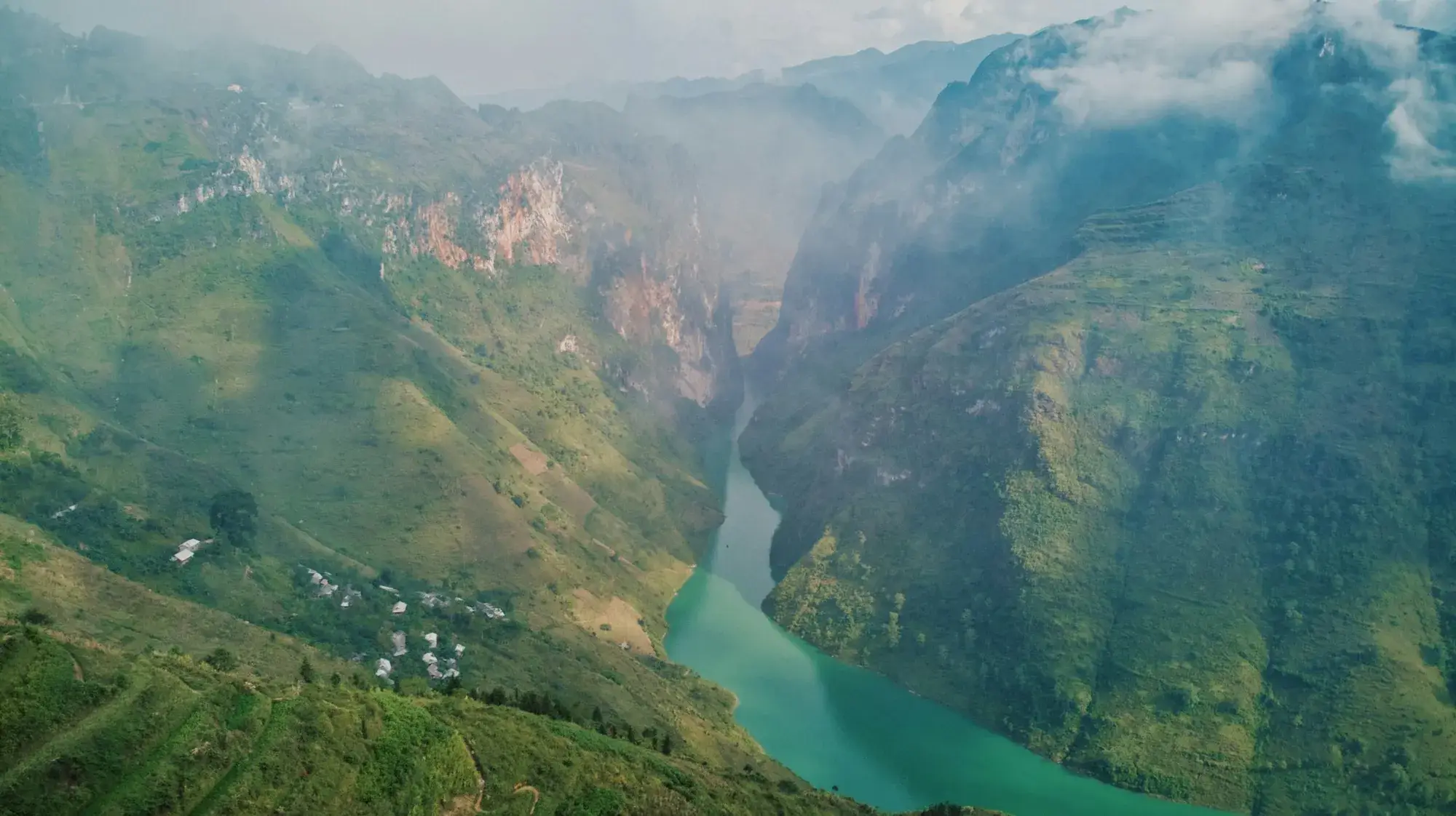
Dropping precipitously from the crest of the Ma Pi Leng pass down to the emerald floor of the Nho Que River, Ta Lang pass in the Meo Vac region is one of the most exhilarating and technically demanding descents in northern Vietnam. Paved with concrete and hugging sheer limestone cliffs, this extraordinary road serves as the gateway to Tu San canyon and Ta Lang village.
More than forty hairpin bends
Over a descent of roughly eight kilometres, the road snakes down a vertical gradient exceeding 15 percent, twisting through more than 40 razor-sharp switchbacks. From high above, the pass resembles a giant silk ribbon discarded across the grey karst mountainside. As you descend, the roaring wind of the high pass softens, replaced by the tranquil breeze rising off the river gorge.
Golden hour in Tu San canyon
Late afternoon, particularly between 15:30 and 17:00, is the magic window for travelling Ta Lang pass. As the sun sinks behind the peaks of Dong Van, horizontal beams of amber light shoot through natural clefts in the canyon walls, illuminating the turquoise river and casting long sculptural shadows across the switchbacks.
Four seasons across the switchbacks
Conditions and scenery along Ta Lang pass shift markedly across the calendar:
- Spring (January to March): Dense morning mist frequently blankets the upper switchbacks, reducing visibility to a few metres and requiring slow riding with headlights on. By midday, clouds burn off to reveal peach and plum blossoms framing the cottages of Ta Lang village below.
- Summer (April to June): Direct mountain sunshine floods Tu San canyon, illuminating the turquoise Nho Que River at its brightest intensity. The dry concrete surface provides reliable tyre traction on steep hairpins.
- Autumn golden hour (July to September): Terraced corn patches clinging to razor-sharp karst walls ripen into warm golden tones. Between 15:30 and 17:00, low horizontal sunlight streams through deep rock clefts, casting long dramatic shadows across the switchbacks.
- Winter chill (October to December): Buckwheat blossoms tint the rocky road edges in soft pink hues. Cold mountain winds sweep through the gorge while low mists drift across the river, creating an atmospheric, cinematic landscape.
Critical mountain driving safety
Descending Ta Lang pass demands respect, vehicle preparation, and sound riding technique:
- Never ride an automatic scooter: Continuous 15 percent gradients overheat scooter brakes within minutes, risking complete brake failure.
- Rely on first and second gear: Use engine braking on a semi-automatic or manual bike to regulate downhill pace. Feather both brakes intermittently rather than clutching them continuously, and never coast in neutral.
- Yield to uphill local riders: Local motorcycle taxis carrying passengers uphill need momentum to clear tight corners; pull safely toward the mountain wall to give them right of way.
- Inspect brakes and tyres beforehand: Check brake pad wear and tyre pressure at the Pai Lung turn-off before committing to the steep descent.
Practical Observations
- Always check your brake pads before descending; use first and second gear to let engine compression control your speed.
- The golden hour between 15:30 and 17:00 provides the most striking natural lighting for photographs.
- If riding yourself feels intimidating, local motorcycle taxi riders in Pai Lung offer safe, experienced round-trip rides.
Related story
The Dong Van Karst Plateau: what a UNESCO Global Geopark means for your trip
Most of the Ha Giang Loop runs through a UNESCO Global Geopark of 2,356 km². What that title means, what you will see, and how to travel it well.
Good to know before you go
Can automatic scooters ride down Ta Lang pass?
Riding automatic scooters down Ta Lang pass is strongly discouraged. Automatic brakes can easily overheat and fail on the continuous 15 percent gradient. Use a semi-automatic or manual bike in low gear.
How long does it take to descend Ta Lang pass?
The 8-kilometre descent typically takes 20 to 30 minutes of careful, slow riding, depending on road conditions and passing traffic.


