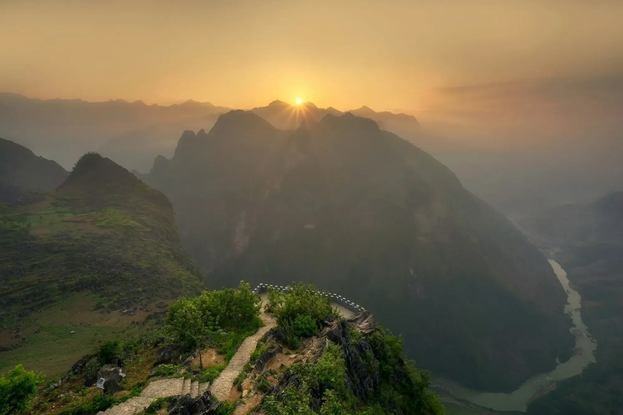
Short answer: What is the Ha Giang Loop?
The Ha Giang Loop is not a rigid package tour, but a 350 km mountain circuit following National Highway 4C through the UNESCO Dong Van Karst Plateau Geopark. Starting and ending in Ha Giang Town, it loops through Quan Ba, Yen Minh, Dong Van, and Meo Vac. While 4 days and 3 nights is the gold standard, the loop adapts to 3-day sprints, relaxed 5 to 6-day journeys, motorbikes, or private cars.
I grew up in this region. I remember riding old Russian UAZ jeeps when the road up to Dong Van was nothing more than loose river boulders, where a single summer landslide could leave you stranded on a pass for days. Today, National Highway 4C is paved with smooth tarmac, welcoming homestays dot the valleys, and thousands of travellers arrive each week.
Yet popularity has brought an unfortunate rush: travellers speeding to complete the loop in three frantic days, snapping quick photos before riding through treacherous evening fog. Many miss the real point: The true soul of Ha Giang has never been about asphalt speed; it is about what reveals itself when you switch off the engine.
It lives in dry-stone walls stacked by hand without mortar in Sung La Valley, a steaming bowl of highland chicken pho at 5 AM, wooden buffalo bells clinking through morning mist, and corn wine shared beside a clay hearth in Thon Tha Village. This guide offers candid, practical advice from someone who calls this place home — designed to help you ride slower, travel safely, and understand this frontier deeply.

Route Anatomy
The 350 km journey across 6 regions
A dramatic elevation profile rising from river valleys to 1,500m limestone passes
The entire loop follows National Highway 4C traversing six distinct geological and cultural regions. Think of it not as a tick-box itinerary, but as an alpine progression:
Leg 1: Ha Giang Town to Quan Ba (~46 km)
Leaving town, the road follows the river before ascending sharply into the switchbacks of Bac Sum Pass. Breaching Quan Ba Heaven Gate at over 1,000m, the air chills instantly as Tam Son valley and the Twin Mountains open up far below.
Leg 2: Quan Ba to Yen Minh (~50 km)
Tracing the turquoise Mien River beneath sheer limestone crags, the road climbs through fragrant Yen Minh Pine Forest before dropping into the valley town of Yen Minh for lunch.
Leg 3: Yen Minh to Dong Van (~50 km) & Lung Cu Detour
Climbing the iconic curves of Tham Ma Slope, you enter the geological heartland. Pass clay houses in Sung La Valley, visit the historic Vuong Family Palace in Sa Phin, or take the northern 25 km detour to Lung Cu Flag Tower and ancient Lo Lo Chai Village near Border Marker 428.
Leg 4: Dong Van to Meo Vac over Ma Pi Leng Pass (~30 km)
Vietnam's most dramatic 20 km stretch of mountain tarmac, cut directly into towering limestone precipices. Perched 800m above Tu San Canyon and the emerald Nho Que River, this is the emotional peak of the loop before descending into Meo Vac.
Leg 5: Meo Vac via Du Gia back to Ha Giang Town (~100–120 km)
Crossing wild Mau Due mountain passes, descend into lush Tay valleys at Du Gia Village. Refresh in mountain pools at Du Gia Waterfall, then follow gentle river valleys back to your starting point.
Interactive Map
The Loop Road & 6 Regions
The Loop in six legs≈ 304 km · 110–1,480 m
Heights: terrain estimates (Copernicus DEM) · Hover or click any leg for driving time & key passes.
Best in November & December
November: Buckwheat in full bloom (Dry and cool, cold nights.) · December: Last buckwheat in some years
November guideViewpoints & Passes
The mountain passes and panoramic lookouts that define the Ha Giang Loop — elevation, road conditions and where to stop safely at each one.
Open the themeVillages & Culture
Ethnic minority villages open to respectful visitors on the Ha Giang Loop — who lives there, what to expect, and how to visit without intruding.
Open the themeMarkets
Weekly highland markets across the Ha Giang Loop — which day each one runs, what is sold, how to get there, and how to visit without getting in the way.
Open the themeHistory & Heritage
Historic buildings, French-colonial roads and wartime landmarks on the Ha Giang Loop — the stories behind the places you ride past every day.
Open the themeFood & Drink
Highland dishes worth stopping for on the Ha Giang Loop — thang co, men men, corn wine, and where the locals actually eat along the road.
Open the themeNature & Hiking
Rivers, limestone canyons, old-growth forests and short day-hikes away from the main road on the Ha Giang Loop — trails, distances and access.
Open the themeHidden Gems
Quieter places on the Ha Giang Loop that most riders pass by — shared carefully, with directions, and never the fragile or overcrowded ones.
Open the themeSlow & Family Travel
Ha Giang Loop stops that work for children, older travellers and anyone going by car at a relaxed pace — tested roads, short walks and easy access.
Open the theme- Dong Van old quarterDong Van
- Ma Pi Leng PassMeo Vac
- Quan Ba Heaven GateQuan Ba
- Bac Sum PassQuan Ba
- Chieu Lau Thi peakHoang Su Phi & the West
- Chin Khoanh slopeDong Van
- Coc Pai marketHoang Su Phi & the West
- Dong Van Sunday marketDong Van
- Du Gia valleyYen Minh & Du Gia
- Du Gia waterfallYen Minh & Du Gia
- Hoang Su Phi rice terracesHoang Su Phi & the West
- Khau Vai love marketMeo Vac
- Km 0 marker, Ha Giang TownHa Giang Town
- Lo Lo Chai villageDong Van
- Lung Cu flag towerDong Van
- Lung Khuy caveQuan Ba
- Lung Tam linen villageQuan Ba
- M-shaped pass in Sung MangMeo Vac
- Ma Pi Leng sky pathMeo Vac
- Meo Vac weekly marketMeo Vac
- Nam Dam villageQuan Ba
- Nho Que River & Tu San canyonMeo Vac
- Pa Vi villageMeo Vac
- Pai Lung twin treesMeo Vac
- Pho Bang old townDong Van
- Sung La valley and Pao's houseDong Van
- Tham Ma slopeDong Van
- Thon Tha villageHa Giang Town
- Twin Mountains (Nui Doi), Quan BaQuan Ba
- Vuong family mansion, Sa PhinDong Van
- Xa Phin mossy villageHa Giang Town
- Yen Minh marketYen Minh & Du Gia
- Yen Minh pine forestYen Minh & Du Gia
- Khau Vai canyon on Nho Que 3Meo Vac
- Lao Xa silversmith villageDong Van
- Sao Ha bamboo villageDong Van
- Ta Giao Khau valley villageDong Van
- Ta Lang switchback passMeo Vac
- Then Pa community villageDong Van
- True Northernmost Point and Border Marker 428Dong Van
- 1Ha GiangHa Giang TownKm 0 · Starting point
- 2Quan BaQuan BaHeaven Gate & Twin Hills
- 3Yen MinhYen Minh & Du GiaPine forest & Waterfalls
- 4Dong VanDong VanUNESCO Karst Plateau
- 5Meo VacMeo VacMa Pi Leng & Nho Que
- ★Hoang Su PhiHoang Su PhiThe West · Rice terraces

Pick a region, a theme — or ride the whole Loop

Ha Giang Town
A river valley town where mountain urban life meets living Tay village culture.

Quan Ba
The dramatic limestone gateway where the lowlands give way to karst peaks and Dao homestays.

Yen Minh & Du Gia
Endless pine ridges, an unhurried market town and crystal valley streams on the quiet edge of the karst plateau.

Dong Van
The cultural heart of the UNESCO Global Geopark — where grey stone turns to living heritage, ancient earthen homes shelter traditions, and the sacred northern frontier stands proud.

Meo Vac
Ma Pi Leng Pass, Southeast Asia's deepest karst canyon, and the vibrant frontier market town.

Hoang Su Phi & the West
National heritage cascading rice terraces, ancient Shan Tuyet tea forests, and sea-of-clouds peaks off the classic Loop.
Places with a guide40
Ha Giang Town
Quan Ba
Yen Minh & Du Gia
Dong Van
- Dong Van old quarter ★
- Chin Khoanh slope
- Dong Van Sunday market
- Lao Xa silversmith village
- Lo Lo Chai village
- Lung Cu flag tower
- Pho Bang old town
- Sao Ha bamboo village
- Sung La valley and Pao's house
- Ta Giao Khau valley village
- Tham Ma slope
- Then Pa community village
- True Northernmost Point and Border Marker 428
- Vuong family mansion, Sa Phin
Meo Vac
Hoang Su Phi & the West
Villages on the map
No guide for that yet. Ha Giang has far more places than this — we keep adding more.
Not the full list — Ha Giang has many more places; we keep adding.

Quan Ba
Bac Sum Pass
A steep 10 km climb through jungle just north of Ha Giang town — the road corkscrews up the mountainside toward Quan Ba and the karst plateau beyond.
Best time: Early morning on clear days for the best chance of a cloud sea below the road. Winter mornings are coldest but often most dramatic.
Open the guide
Hoang Su Phi & the West
Chieu Lau Thi peak
A high peak in Hoang Su Phi rising to 2,400 metres, famous for sunrise above a sea of clouds and an adventurous stone stairway climb.
Best time: Clear mornings from October to March for the cloud sea. Start before dawn.
Open the guide
Dong Van
Chin Khoanh slope
Nine tight hairpin turns carved into steep limestone connecting Pho Cao to the Sung La valley on Highway 4C, forming one of Dong Van's most demanding climbs.
Best time: Morning between 7:30 and 9:30 AM for clear photos. Avoid descending in thick winter fog or heavy monsoon rain.
Open the guide
Hoang Su Phi & the West
Coc Pai market
A Sunday market in Coc Pai town where Hmong, Dao and Tay families trade livestock, herbs and handwoven cloth at an unhurried highland pace.
Good to know: Market day: Sunday mornings, from around 6:30 am until late morning.
Open the guide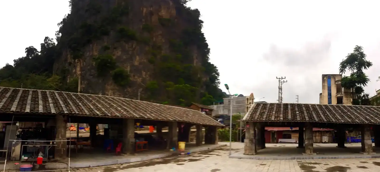
Dong Van · In town · ★ Featured
Dong Van old quarter
A historic trading settlement of century-old rammed-earth and timber courtyard homes beneath towering limestone peaks, serving as the northern hub of the Loop.
Best time: Late evening after 9:30 PM for quiet lantern-lit stone lanes; early morning at 6:00 AM for fresh mountain mist and traditional breakfast.
Open the guide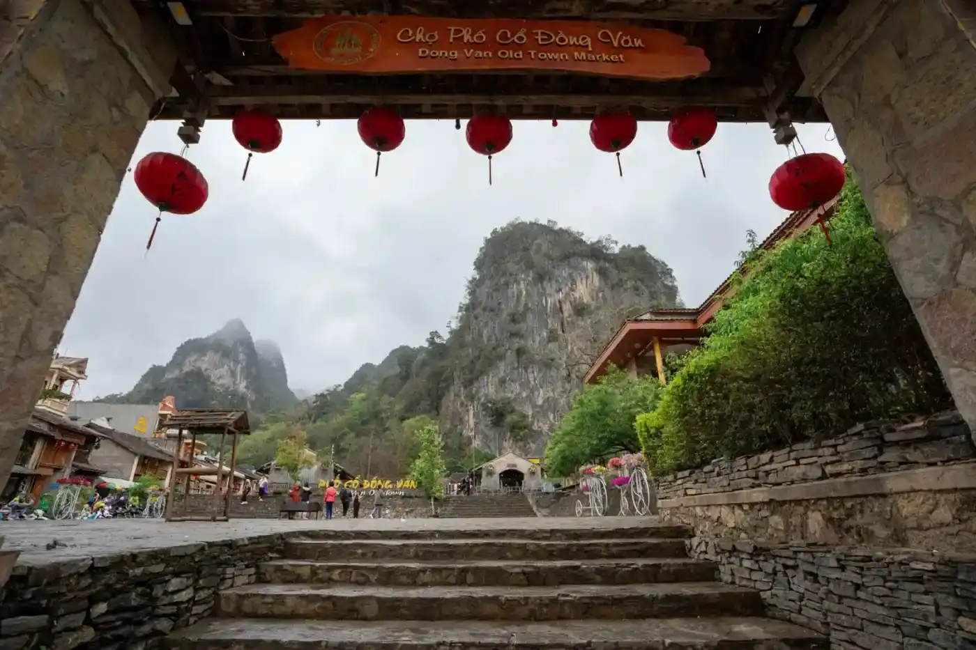
Dong Van · In town
Dong Van Sunday market
The historic Sunday morning market in Dong Van old town, where highland ethnic communities gather to trade livestock, handwoven textiles, and steaming bowls of pho.
Good to know: Takes place every Sunday morning, peaking between 6:30 AM and 9:30 AM. Free admission.
Open the guide
Yen Minh & Du Gia
Du Gia valley
A green valley south of the main Loop road with rice fields, streams and a quieter pace, making it a favourite overnight stop for slower itineraries and families.
Best time: September–October for golden rice terraces, and year-round for the valley experience.
Open the guide
Yen Minh & Du Gia
Du Gia waterfall
A freshwater cascade and natural swimming pool nestled in a lush valley south of the Loop, offering a refreshing swim with strict water safety care.
Best time: Dry season for calm water; avoid swimming after heavy rain.
Open the guide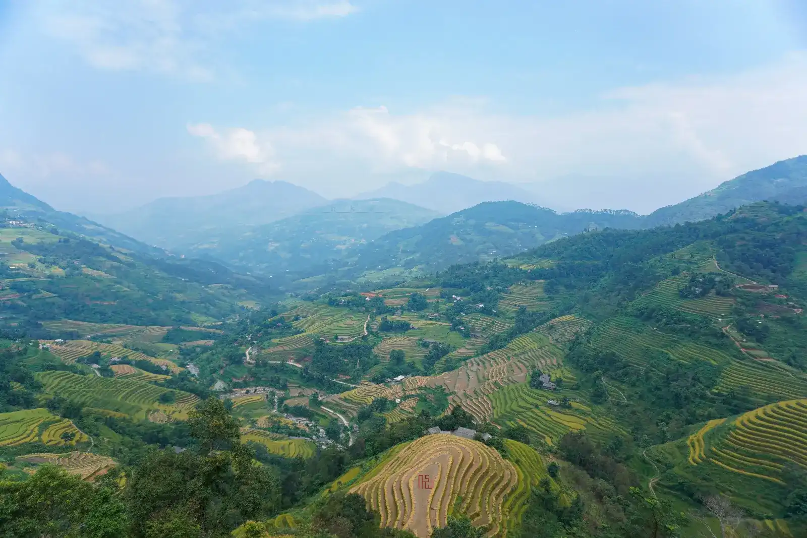
Hoang Su Phi & the West
Hoang Su Phi rice terraces
Stunning terraced hillsides cascading across western Ha Giang, shimmering like mirrors during water-pouring season and glowing golden before autumn harvest.
Best time: Water season around May–June for flooded mirror terraces, and late September to early October for golden rice (timing varies by altitude and year). July–August for the deepest green.
Open the guideMeo Vac
Khau Vai canyon on Nho Que 3
A serene, lesser-known canyon on the lower Nho Que River reservoir in Khau Vai, celebrated for emerald waters, dramatic rock walls, and tranquil kayak exploration.
Good to know: Free area access. Local boat rides and kayak rentals range from 100,000 to 150,000 VND per person.
Open the guide
Meo Vac
Khau Vai love market
A once-a-year festival market near Meo Vac held in late spring, weaving together old highland legends, quiet reunions and a colourful fair.
Best time: Only around the 27th day of the third lunar month (usually late April or May); check the exact date for the year before you plan.
Open the guide
Ha Giang Town · In town
Km 0 marker, Ha Giang Town
The roadside stone marker in Ha Giang city where riders take their very first photo before setting off into the northern mountains.
Best time: Early morning, before 7 am, for the marker without a crowd.
Open the guideDong Van
Lao Xa silversmith village
A quiet traditional Hmong settlement tucked behind Sung La valley, where artisans of the Mua clan hand-forge ornate silver jewellery beside stone-walled courtyards.
Good to know: Free to visit. Modest prices for direct handmade silver purchases.
Open the guide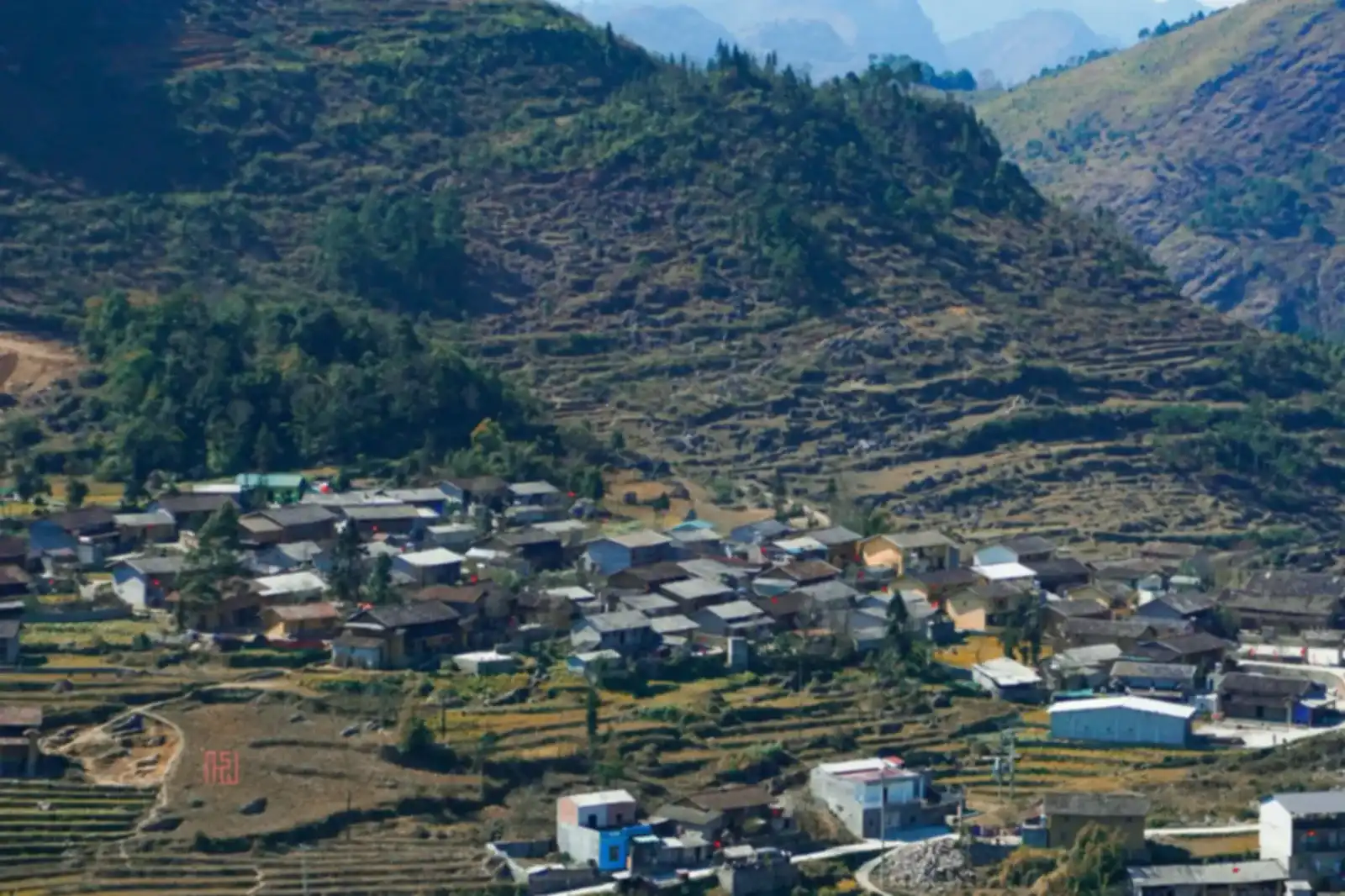
Dong Van
Lo Lo Chai village
A living Black Lo Lo border village of rammed-earth homes beneath Lung Cu flag tower, named a UN Tourism Best Tourism Village in 2025.
Good to know: Walking through public village lanes is completely free. Homestay accommodation, traditional family meals, and folk cultural evenings are paid directly to local Lo Lo hosts.
Open the guide
Dong Van
Lung Cu flag tower
Vietnam's northernmost national monument perched atop Dragon Mountain at 1,470 metres, commanding panoramic views of border karst ridges and ancestral valleys.
Good to know: Admission: 40,000 VND per adult; children under 1.2 m enter free. Electric cart: 30,000 VND round trip. Open daily from 7:00 AM to 5:30 PM.
Open the guide
Quan Ba
Lung Khuy cave
A lit show cave tucked high on a Quan Ba hillside, reached by a scenic uphill footpath providing a cool respite from the highway.
Good to know: About 50,000 VND per person, open daily 7 am to 7 pm (indicative, checked 2025).
Open the guide
Quan Ba
Lung Tam linen village
A Hmong women's cooperative in Quan Ba where you watch the full hemp-to-linen process — from pulling fibre to indigo dyeing — and buy directly from weavers.
Good to know: You can walk in and watch the weaving for free. Support the local craftswomen by picking up handmade linen items at the workshop.
Open the guide
Meo Vac
M-shaped pass in Sung Mang
An iconic engineering marvel along the mountain highway connecting Yen Minh and Meo Vac, where the road carves a flawless M-shape across limestone ridges.
Good to know: Free public roadside viewpoint accessible all day.
Open the guideMeo Vac · ★ Featured
Ma Pi Leng Pass
A 20 km mountain pass between Dong Van and Meo Vac, carved into cliffs high above the Nho Que River and Tu San canyon on the Ha Giang Loop.
Best time: Dry, clear mornings from October to March typically give the best views of the canyon. Come before 9 a.m. if you can.
Open the guide
Meo Vac
Ma Pi Leng sky path
An exhilarating cliffside single-track trail etched into the White Rock Cliff above Tu San canyon, offering unobstructed aerial panoramas of the Nho Que River.
Good to know: Hiking the walking trail is free. Optional local motorcycle taxi shuttle on the lower concrete road costs 50,000 to 100,000 VND per ride. Parking is 5,000 to 10,000 VND.
Open the guide
Meo Vac · In town
Meo Vac weekly market
The weekly Sunday market in Meo Vac town, where Hmong, Lo Lo and other communities from the surrounding highlands come to trade, eat and meet.
Good to know: Every Sunday, from early morning (around 6:00 am) until midday.
Open the guide
Quan Ba
Nam Dam village
A small Dao community tourism village below Quan Ba Heaven Gate, known for herbal baths, quiet homestays and a preserved way of life.
Good to know: Walking through the village is free. If you want to take a traditional Dao herbal bath, your homestay host will gladly prepare a hot wooden tub for roughly 80,000 to 100,000 VND.
Open the guide
Meo Vac
Nho Que River & Tu San canyon
The turquoise river at the bottom of the deepest canyon in Southeast Asia, reached by a steep side road from Ma Pi Leng Pass.
Best time: Morning brings the best light in the canyon; check boat availability after heavy rain.
Open the guide
Meo Vac
Pa Vi village
A quiet Hmong village 5 km from Meo Vac town — stay in a traditional homestay and ride Ma Pi Leng Pass at dawn before the tourist traffic starts.
Best time: Late afternoon for warm light on the valley, or stay overnight to experience evening village life.
Open the guide
Meo Vac
Pai Lung twin trees
Two resilient trees standing solitary amid a surreal sea of jagged grey limestone in Pai Lung, epitomising the raw, unadorned spirit of the karst plateau.
Good to know: Free public roadside viewpoint.
Open the guide
Dong Van
Pho Bang old town
A serene border town tucked in a limestone valley just off the main road, characterized by century-old clay homes and a peaceful rotating six-day market.
Good to know: The rotating market meets every six days on Rat and Horse days in the twelve-animal zodiac cycle, operating only in the morning until around noon.
Open the guideQuan Ba · ★ Featured
Quan Ba Heaven Gate
The first major pass on the Loop, 45 km north of Ha Giang town — stop at the viewpoint for Tam Son valley and the Twin Mountains (Nui Doi) below.
Best time: Clear afternoons for the best view of the valley and Twin Mountains. Mornings can be foggy from November to March.
Open the guideDong Van
Sao Ha bamboo village
A remote Hmong settlement secluded within ancient bamboo groves and jagged limestone cliffs in Van Chai, famed for peaceful silence and stone-walled earthen houses.
Good to know: Free to visit. Please leave before twilight to allow families their quiet evening routines.
Open the guide
Dong Van
Sung La valley and Pao's house
A wide agricultural basin below Chin Khoanh pass, famed for traditional Hmong earthen homesteads, seasonal flower plots, and the film set of Pao's Story.
Good to know: Pao's house admission: 10,000 VND per visitor. Managed roadside flower plots charge 10,000 to 20,000 VND per person. Open daily during daylight hours.
Open the guideDong Van
Ta Giao Khau valley village
A quiet Hmong hamlet just over one kilometre from Lo Lo Chai, offering panoramic valley vistas, traditional stone-fenced homes, and unhurried agricultural life.
Good to know: Free public access. Please leave before nightfall to respect local family routines.
Open the guideMeo Vac
Ta Lang switchback pass
A dizzying descent of more than 40 sharp switchbacks plunging from Pai Lung down to the jade waters of the Nho Que River, bathed in golden afternoon sunlight.
Good to know: Free road access. Boat rides along the canyon require separate fees at the terminal.
Open the guide
Dong Van
Tham Ma slope
The iconic mountain pass climbing out of Yen Minh into Dong Van karst plateau, famous for sweeping U-curves, horse-testing lore, and dramatic canyon views.
Best time: Morning between 8:30 AM and 10:30 AM when valley fog lifts and sunlight illuminates the pass without casting heavy cliff shadows.
Open the guideDong Van
Then Pa community village
An intimate hamlet of just over ten Hmong families resting beside the Dragon Eye lake in Lung Cu, celebrated for hand-stacked stone walls, earthen architecture, and warm community hospitality.
Good to know: Free to visit. Modest homestay and meal fees when staying with local host families.
Open the guide
Ha Giang Town
Thon Tha village
A peaceful Tay village of stilt houses and rice fields just outside Ha Giang city, perfect for a gentle night before or after the mountain roads.
Best time: Morning hours for soft light and a quiet walk through the village before tour groups arrive.
Open the guideDong Van
True Northernmost Point and Border Marker 428
Vietnam's geographical northernmost extremity above the Nho Que River in Xeo Lung, distinct from Lung Cu Flag Tower and reached via a scenic cliffside footpath.
Good to know: Free to visit. Please bring personal ID (passport or citizen card) for border verification if requested by frontier patrols.
Open the guide
Quan Ba
Twin Mountains (Nui Doi), Quan Ba
Two rounded limestone hills rising naturally from Tam Son valley paddies, viewed from Quan Ba Heaven Gate or during a quiet stroll through the fields.
Best time: Afternoon for photography from the Heaven Gate. September for golden rice contrasting with the green hills.
Open the guide
Dong Van
Vuong family mansion, Sa Phin
An extraordinary fortress-mansion built by Hmong chieftain Vuong Chinh Duc in Sa Phin valley, blending Chinese Qing-era courtyards with French military bastions.
Good to know: Admission: 30,000 VND per adult; children under 1.2 m free. Open daily from 7:00 AM to 5:00 PM.
Open the guide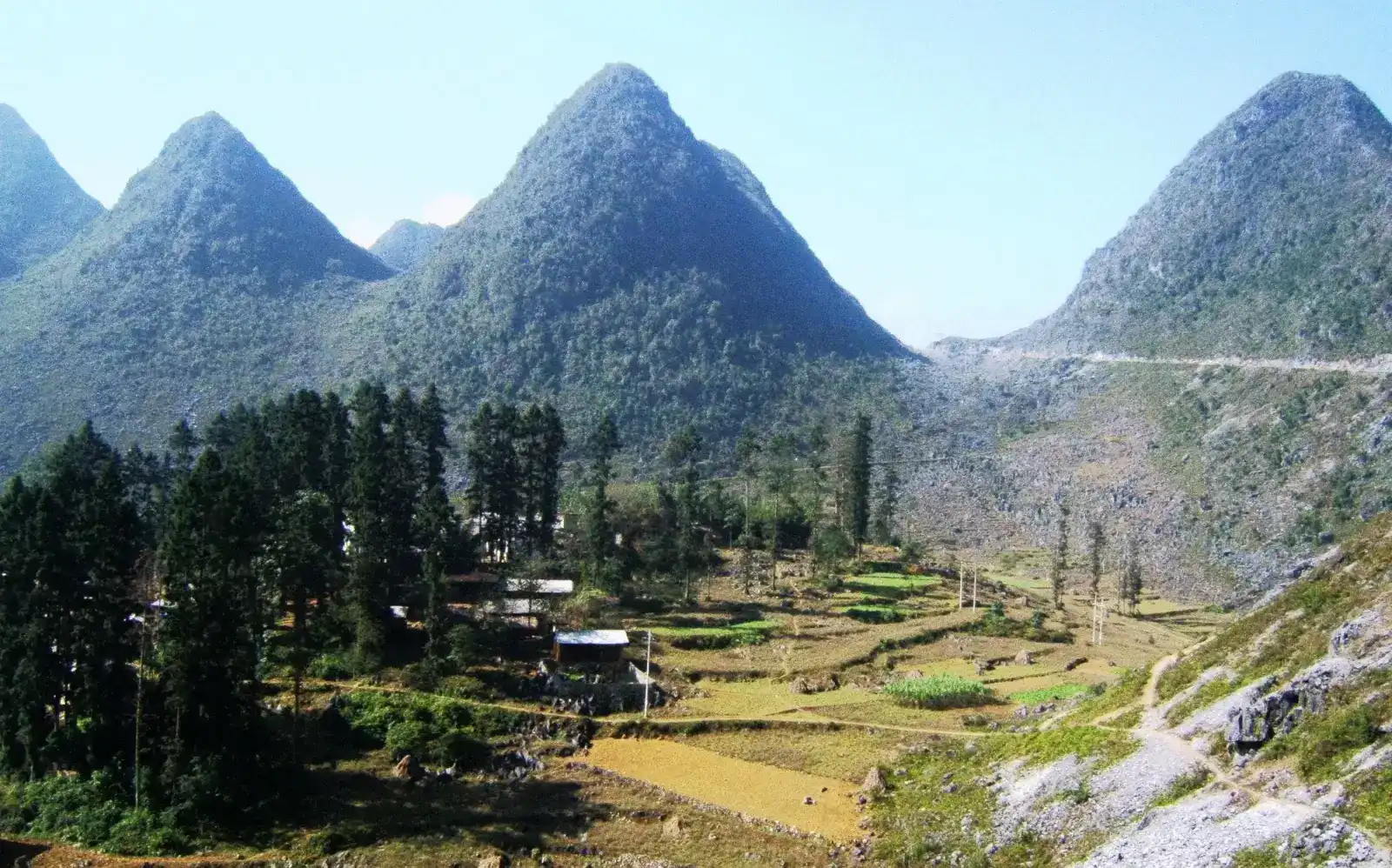
Ha Giang Town
Xa Phin mossy village
A quiet Dao village nestled on the misty slopes of Tay Con Linh, famed for moss-draped palm-leaf roofs, ancient tea groves, and terraced rice fields.
Good to know: Open freely all day. Please respect village quietude after nightfall.
Open the guide
Yen Minh & Du Gia · In town
Yen Minh market
The bustling town market of Yen Minh at the midway point of the Loop, offering an authentic morning market atmosphere and affordable local noodle lunches.
Good to know: Open daily, with Sunday as the main market day, busiest in the morning.
Open the guide
Yen Minh & Du Gia
Yen Minh pine forest
Tall green pines line the mountain road between Quan Ba and Yen Minh, offering riders a cool and fragrant breather before entering the rocky plateau.
Best time: Early morning or late afternoon for the softest light filtering through the pines. Misty mornings add atmosphere.
Open the guideClick on regions or route markers to view terrain elevation, towns, and attractions along the highway.
Route Direction
Clockwise vs Counter-Clockwise: Which way is best?
How direction changes your scenery reveals and helps bypass peak crowds
Most generic guides prescribe only one way: clockwise. Yet local riders understand that reversing the circuit completely alters your experience:
1. Clockwise: The Classic Scenery Progression
Ha Giang Town → Quan Ba → Yen Minh → Dong Van → Meo Vac → Du Gia. The standard progression for first-time visitors. Elevation climbs naturally: rolling green foothills give way to jagged stone pinnacles, culminating with awe-inspiring Ma Pi Leng Pass on day three. Hairpin switchbacks also feel more intuitive for descending riders.
2. Counter-Clockwise: The Insider Crowd-Buster
Ha Giang Town → Du Gia → Meo Vac → Dong Van → Yen Minh → Quan Ba. If departing town on a Saturday morning, this is an invaluable local tactic. While tour convoys queue up Bac Sum pass, you slip east into peaceful backcountry toward Du Gia. You swim in empty waterfalls and cross Ma Pi Leng at dusk in pristine mountain quiet.

Transport Comparison
Three ways to travel: Honest trade-offs and safety
There is no single best way; choose what matches your riding skills and travel style
Your transport defines fatigue, risk and perception. Here is the unembellished assessment:
1. Self-Riding a Motorbike
Highest RiskMaximum freedom to stop at any viewpoint, completely exposed to mountain air and woodsmoke scents. But concentration is exhausting. Steep 10% gradients, quarry trucks crossing the centreline, loose gravel, and blinding fog. The nearest trauma hospital is 5 to 6 hours away in Hanoi. Only self-ride if you hold a valid 1968 IDP and genuine mountain experience.
2. Riding Pillion with an Easy Rider
Best BalanceYou ride pillion behind a seasoned local motorcyclist who knows every curve and timing. You gain 360-degree panoramic immersion, filming and photographing freely without hand-cramping brake strain. The most sensible option for first-time visitors or riders without motorcycle licences.
3. Private Car with a Local Driver
Comfort & FamiliesSome assume cars lack adventure, but Ma Pi Leng looks just as breathtaking through an SUV window. A car protects you from monsoon cloudbursts, freezing winter temperatures, keeps luggage spotless, and provides unmatched security for families, kids, or older travellers. Split among 3 to 5 people, it is exceptionally cost-effective.
Accommodation Styles
Where to stay: Stilt houses, clay homestays, or town hotels?
Your bed in Ha Giang shapes half of your trip memories
We accept no booking kickbacks. Here is an honest appraisal of the three main sleeping styles across the loop:
1. Tay Timber Stilt Houses (Thon Tha, Du Gia)
Tucked into lush green valleys beside bubbling streams and rice paddies. Raised timber floors stay naturally cool in summer. Communal dinners around bamboo mats make for a peaceful, unhurried rural retreat. Light sleepers should bring earplugs as wooden floorboards carry footsteps.
2. Ancient Rammed-Clay Homestays (Lo Lo Chai, Sung La, Pho Bang)
The signature highland architecture. Walls packed half a metre thick insulate against harsh weather: even when outdoor temperatures dip below 5°C in winter, the interior stays warm beside wood embers. Sleeping in Lo Lo Chai beneath Dragon Mountain is unforgettable. Book well ahead during autumn flower season.
3. Town Hotels & Guesthouses (Ha Giang Town, Dong Van, Meo Vac)
Best if you prioritise private en-suite bathrooms, reliable hot water, and instant walking access to weekend market stalls. Functional and convenient, though less culturally immersive. Note that central Dong Van can be noisy with loudspeaker karaoke on Saturday evenings.

Highland Flavours
Highland food: Genuine flavours and honest notes
Hearty mountain cooking built to warm travellers against sharp highland winds
Karst plateau food is rustic, comforting and hearty. Here are the genuine specialities to taste along your ride:
Trang Kim Chicken Pho in Quan Ba
Handmade thick rice noodles dried on bamboo poles beside mountain streams, topped with firm free-range chicken and warming highland ginger broth. Stalls near Trang Kim bridge steam freshest before dawn.
Steamed Egg Crepes in Rich Bone Broth
Unlike lowland banh cuon served with cold sauce, mountain rice rolls wrap around a runny egg yolk and submerge into a piping-hot bowl of rich pork marrow broth seasoned with wild chilies to combat dawn chills.
Au Tau Porridge in Dong Van
Aconite root simmered for eight hours to neutralise toxins, cooked into rich pork knuckle rice congee with raw egg yolks and perilla herb. Bitter on first sip, intensely sweet on the finish; the ultimate cold-night remedy after windblown riding.
Thang Den Warm Ginger Dumplings
Chewy upland glutinous rice dumplings served floating in a spicy ginger cane syrup topped with roasted peanuts and sesame. Eating a steaming bowl by charcoal braziers in Dong Van old quarter is an unforgettable winter night ritual.
Charcoal-Grilled Buckwheat Cakes
Buckwheat seeds ground, steamed, and toasted over charcoal braziers at Dong Van Market and Meo Vac Market. Nutty, crumbly and warming pocket food for pass stops.
Leaf-Yeast Corn Wine & Market Thang Co
Traditional horse-organ stew cooked in giant market woks carries a pungent aroma that divides opinions, but pairs memorably with herbal leaf-fermented corn liquor. Try a small sip in a market corner to taste century-old trading heritage.
In-Depth Food Guide & 350 km Loop Dining Rhythm
Read our complete local food guide: What to Eat in Ha Giang: An Honest Local Food Guide featuring 10 highland specialties, authentic photos, and practical dining milestones along the loop.

Transport From Hanoi
Getting from Hanoi to Ha Giang
Ha Giang town is 300 km north of Hanoi, with no airport or railway
With no airport or train lines in the mountains, all travellers arrive by road from Hanoi via the Tuyen Quang expressway:
1. Overnight Sleeper Buses
Departing My Dinh terminal around 8 to 10 PM, arriving in Ha Giang at 4 to 5 AM. The classic backpacker choice saving one night of hotel costs and arriving ready for dawn departure.
2. VIP Limousines & Cabin Vans
Reclining luxury seats or private curtained cabins picking up door-to-door in Hanoi Old Quarter. Operating both daytime and evening, taking 5 to 5.5 hours with superior comfort.
3. Private Airport Transfer
Direct 7-seater SUV greeting you at Noi Bai Airport arrivals, driving straight into the mountains without city transfers. The premier choice for families or small groups carrying gear.
Trip Budget
What it genuinely costs
Transparent budget breakdowns for a typical 4-day circuit
| Travel Style | Transport & Driver | Rooms & Meals | Estimated Total (4 days) |
|---|---|---|---|
| Self-ride (Budget) | Bike rental 150k/day + gas 250k | Dorm beds 120k + local eateries | 2,500,000 – 3,500,000 VND(~$100–$140 USD) |
| Easy Rider Package | Driver, bike, fuel included | Homestay rooms + communal meals | 4,500,000 – 6,500,000 VND(~$180–$260 USD) |
| Private Car with Driver | Private vehicle, driver, tolls | Comfortable private rooms + dining | 6,000,000 – 10,000,000 VND(~$240–$400 USD / group) |
Local food along the highway is remarkably affordable: a hot bowl of pho runs 35,000 to 45,000 VND (~$1.50–$1.80); communal homestay dinners average 100,000 to 150,000 VND (~$4–$6) per person; entry fees for sites like the Hmong King Palace or Lung Cu Tower are just 10,000 to 30,000 VND (~$0.40–$1.20).
* Indicative exchange rate: 1 USD ≈ 25,000 VND. Cash payments on the Loop (homestays, roadside eateries, fuel) are settled in Vietnamese Dong (VND).
Survival & Laws
Road safety, licences and border permits
Essential legal requirements and survival rules for mountain passes
Ha Giang province has no medical helicopter evacuation. Local hospitals handle basic stabilisations, but serious fractures or neuro-trauma require a 5 to 6-hour road ambulance transfer to Hanoi. Never speed, never drink corn wine before driving, and always reach your night stop before 5:30 PM when mountain fog rolls in.
Licence laws: Riding a motorcycle legally in Vietnam requires an International Driving Permit issued under the 1968 Vienna Convention alongside your home motorcycle endorsement, or a Vietnamese licence. Most rental shops do not verify papers, but if you crash without valid credentials, international travel insurers will completely void medical coverage.
Border Permit: Required for all foreign passport holders visiting border communes in Dong Van, Meo Vac, and Lung Cu. The official fee is 250,000 VND (~$10 USD), obtained at the provincial immigration office in Ha Giang town within 30 minutes, or arranged through your guesthouse.
Field Preparation
Practical essentials for the road
Cash, SIM connectivity, weather packing, and respectful travel etiquette
Fuel Stops & Mountain Supply Gaps
Always top up at official petrol stations in district towns (Ha Giang city, Tam Son, Yen Minh, Dong Van, Meo Vac). Crucial note: The 45 km mountain stretch between Meo Vac and Du Gia via Mau Due (Route DT176) is remote and has zero official petrol stations (only sporadic roadside bottled fuel). Always refill your tank completely before leaving Meo Vac or Yen Minh.
Engine Braking & Brake Fade Prevention
When descending long steep gradients (Bac Sum pass, Ma Pi Leng pass, Chin Khoanh slope): Never hold the clutch in to freewheel or coast in neutral. Keep the bike in 2nd or 1st gear so engine compression restrains your speed, tapping brakes only in gentle bursts. Constant dragging of brakes on steep descents overheats the pads and boils brake fluid, risking complete loss of stopping power.
Cash & Mountain ATMs
Withdraw sufficient cash in Ha Giang town. The few ATMs in Yen Minh and Dong Van frequently run out of banknotes on peak weekends. Homestays and rural food stalls rely on cash; international credit cards are virtually useless once on the road.
SIM & Offline Navigation
Viettel is the only network with reliable highland coverage. However, signals drop in deep canyons and along remote backcountry valleys. Download offline maps via Google Maps or Maps.me before leaving Ha Giang town.
The Layering Rule
Temperatures swing up to 15°C between midday sun and evening pass winds. Dress in versatile thin layers: breathable base, fleece mid-layer, and waterproof windbreaker shell. Always pack gloves and dust neck gaiters.
Responsible Travel Etiquette
Never hand cash or candy to children standing along the roadsides, as this encourages begging and truancy. Ask permission before taking portrait photos, dress modestly in villages, and pack out all plastic rubbish.


